San Diego International Airport (SAN)
Driving Directions / Travel by Car
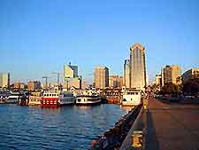
(San Diego, California - CA, USA)
With excellent road access, San Diego International Airport (SAN) is conveniently close to the main I-5 (San Diego Freeway) route, which runs right past the airport, linking it with downtown San Diego. There are also connections to state route US-163, and I-8 (Mission Valley Freeway) and I-15 (Escondido Freeway) interstates.
To the south of San Diego Airport, the North Harbor Drive runs in an east-west direction, past the Spanish Landing Park, whilst on the northern side, Barnett Avenue skirts the perimeter, off Lytton Street and Rosecrans Street. The US Marine Corps Recruitment Depot is located to the north of the airport, with the US Naval Training Center to the west, separated by San Diego Bay.
Directions to San Diego International Airport (SAN) from the north:
- Head south along the I-5 interstate, towards the city of San Diego
- Take the Airport Exit onto Kettner Boulevard
- Turn right onto West Laurel Street and merge with North Harbor Drive for the airport
Directions to San Diego International Airport (SAN) from the south:
- Head north on the I-5 interstate, passing downtown San Diego
- Take the Airport Exit onto West Hawthorn Street
- Turn right onto North Harbor Drive for the airport
Directions to San Diego International Airport (SAN) from the east:
- Head west on state Highway 94
- Turn right onto the I-5 interstate north
- Exit onto West Hawthorn Street and then turn right onto North Harbor Drive for the airport
Directions to San Diego International Airport (SAN) from the west:
- Highway 209 and North Harbor Drive come in from the west from Sunset Cliffs and Roseville
Interstate 5 is the main north-south artery for the Western Seaboard and it becomes fairly busy in the daytime around downtown San Diego and the airport, as does state Highway 94 and the I-8 interstate. We recommend that you allow yourself extra time when traveling to San Diego Airport during morning and afternoon rush hours.
San Diego International Airport (SAN): Virtual Google Maps
